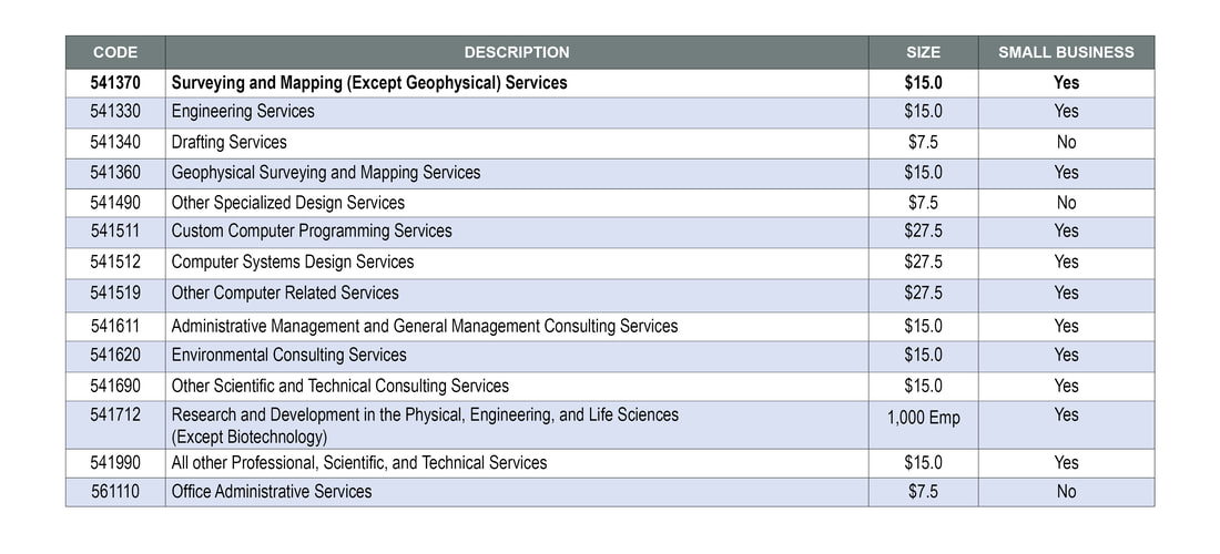
Wiser is a certified small business firm offering a broad range of Geospatial Production, Analysis as a Service, Intelligence Analysis and Information Technology services.
Wiser provides the agility and efficiency of a small business as well as the low risk of quality and performance of being a premier GEOINT services provider. Wiser’s unique approach includes offering products and services as a single unified company.
We provide a comprehensive team of skilled professionals, armed with an array of state-of-the-art equipment and techniques. Customers rely on us for support under crisis situations and during times of competing priorities knowing the Wiser team will always maintain the highest dedication to quality.

